Perhaps you’ve heard someone talk about Shoreline Master Plans, or the Shoreline Master Program (SMPs). And you’ve probably thought that shoreline planning sounds like a good idea, but what is it? In Washington State, any county or city that has a shoreline is required by state law to develop a plan to manage those shorelines in order to preserve ecological functions, offer public access, and ensure businesses that require water access aren’t squeezed out. Over the last decade all counties and municipalities in Washington State have been required to update their plans.
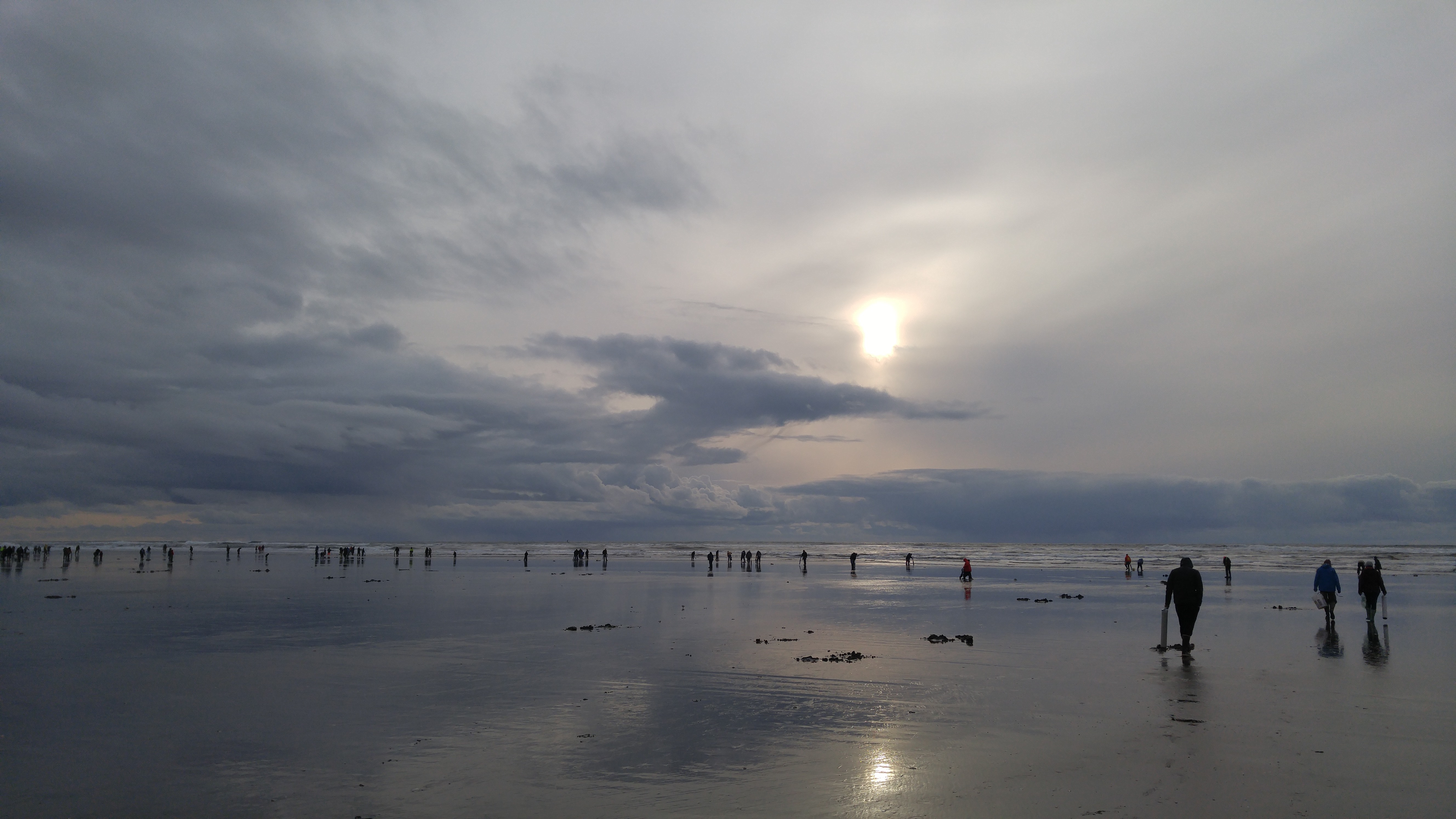
Razor clam digging is a popular recreational activity on Washington's Pacific shorelines
The last couple of years Surfrider has supported and been an active participant in the process to update the SMPs in Grays Harbor and Pacific Counties. Both counties were 20 or more years removed from their last update, so it was long overdue. After this round of updates is finished, the plans are required to be updated every 8 years.
There are many great aspects to SMPs. For our recreational interests, it is good to know that public access is a top priority, as is habitat and ecosystem function protections. In fact, there is a requirement of “no net loss” of ecological function on managed shorelines. Additionally, businesses and activities that require access to the shoreline are given priority. This is important because the nature of real estate can often create financial barriers to water access.
SMPs’ legal authority runs through the Washington Department of Ecology but the plans are developed and approved locally. The idea behind this is that local governments have a better understanding of local economics and the pressure on their shorelines. Shoreline master plans basically make local governments manage their shorelines in a smart and comprehensive manner instead of allowing development to occur in a first come, first serve basis that results in losses to access and ecosystem functions.
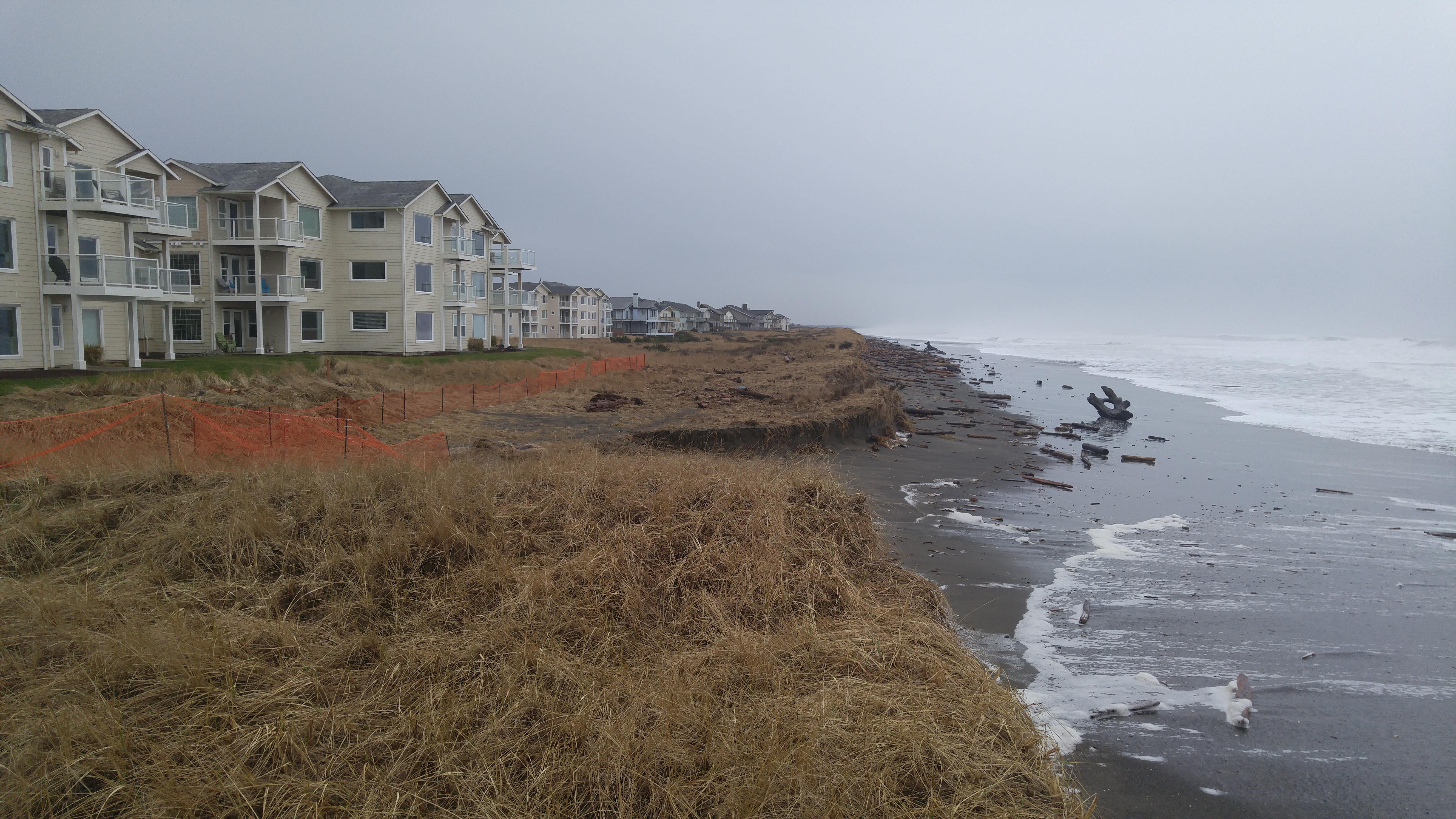 The threatened condominiums in Westport are an example of why smart shoreline planning is critical
It turns out that SMPs are the best way to currently plan for Sea Level Rise (SLR). Infrastructure that is already at risk to SLR and flooding will need to figure out their options. However, areas that are yet to be developed can plan for SLR and avoid building in areas that are projected to be underwater in the near future. This was a major focus in Grays Harbor and Pacific Counties as they have substantial shorelines that will be impacted. While both counties have a lot of policy language in regards to SLR, it required a lot of effort and their was little encouragement from the Department of Ecology to do so. That needs to change for the next round of updates if Washington State is going to seriously prepare for the impacts of SLR.
Another great aspect of SMPs is that a Shoreline Inventory and Analysis Report is required, as is a a restoration plan. The restoration plan does not have a mandate for implementation but it can be a useful tool for local governments as they aim to maintain and/or enhance ecological function of the shoreline.
It's not just government officials that are involved with the process of updating local SMPs. In Grays Harbor and Pacific counties there was robust public involvement. In addition to public workshops, each county had a planning committee that spent months working on each section and carefully considering the implications of various policy scenarios. It was an excellent display of citizen engagement and demonstrates how taking the time to work with community stakeholders can result in a solid product with support from a wide range of interests.
That’s SMPs in a nutshell. They are actually pretty complex when you start getting into the details but we'll save that for another time. Make sure to check back here as we will dive deeper into the process and content of SMP updates in Grays Harbor and Pacific Counties.