
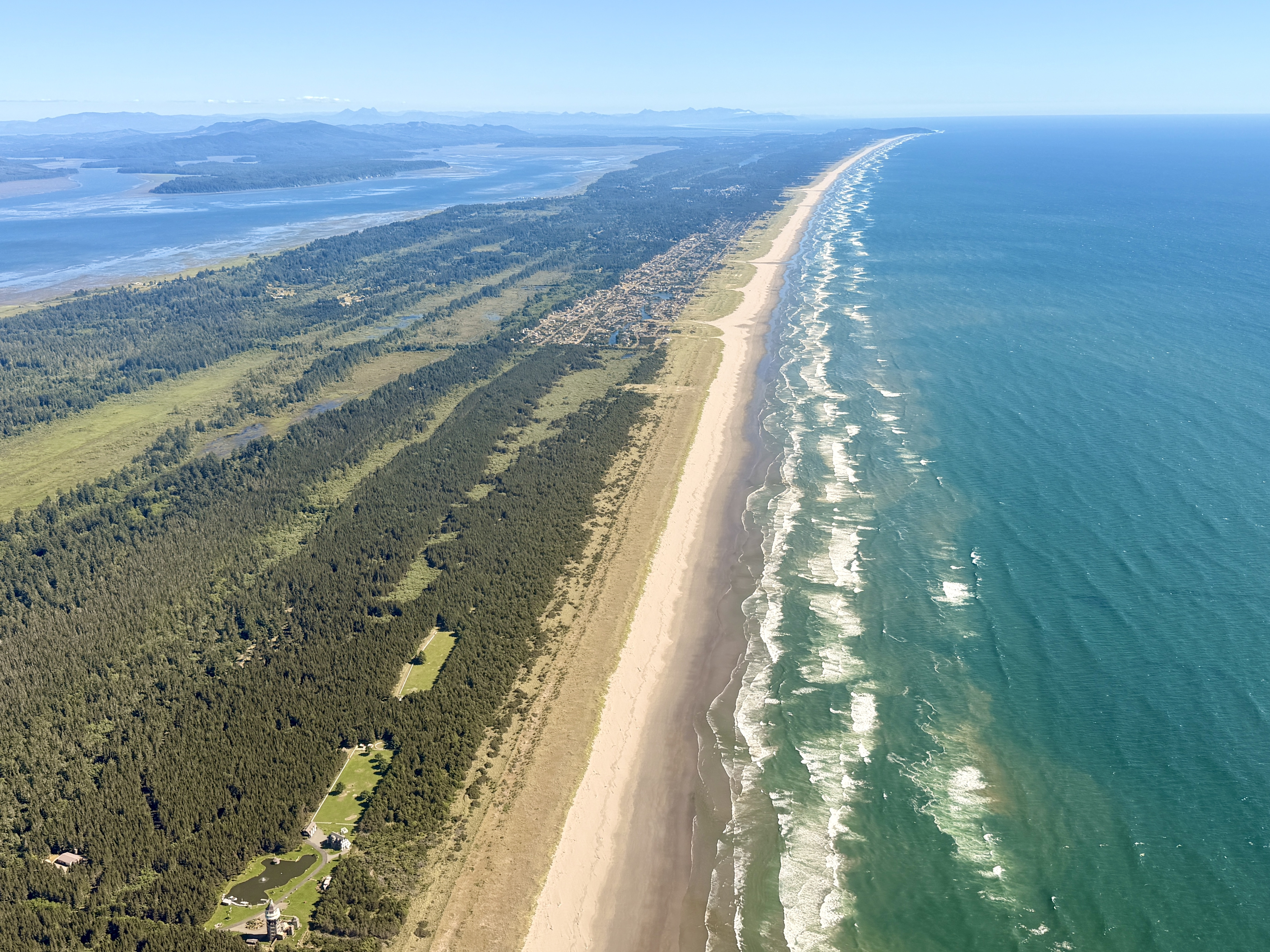
They say a picture’s worth a thousand words. Cliché? For sure. Accurate? Undeniably so.
The old adage seems especially true in our coastal resilience work. It’s one thing to say the seas are rising, or that this beach is washing away. It’s another to see it happening. It’s why we work to bring attention to king tides, encouraging people to take pictures and submit them to the MyCoast app. In years past, we’ve partnered with the non-profit Lighthawk to snap aerial pictures of the beach during king tides to show how vulnerable our coastlines are.
It’s been a few years since our last flight, and the coast has continued to shift and change. So I was stoked with Lighthawk agreed to take us out earlier this summer during their 50 by 50 challenge so we could grab some fresh pics! Yours truly and South Sound Chapter Chair, Brendan Bowen, along with our awesome pilot, Lane, spent an afternoon zipping around in the smallest plane I’ve ever been in. The weather gods smiled upon us, and we got to spend an hour or two cruising at low altitude, taking in the sights from on high.
It’s impossible to deny the impacts of human actions on our landscape when seen from the sky. From the patchwork of clearcuts and early succession forests, to the bright mosaic of farmlands, to the seemingly infinite spans of shopping malls and neighborhoods - when viewed from above, it becomes so apparent just how special those remaining undeveloped, unharvested places are. It’s hard not to think of all the migratory birds that fly thousands of miles every year, and how few and far between their rest stops have become. Imagine driving cross-country with only a handful of gas stations along the way.
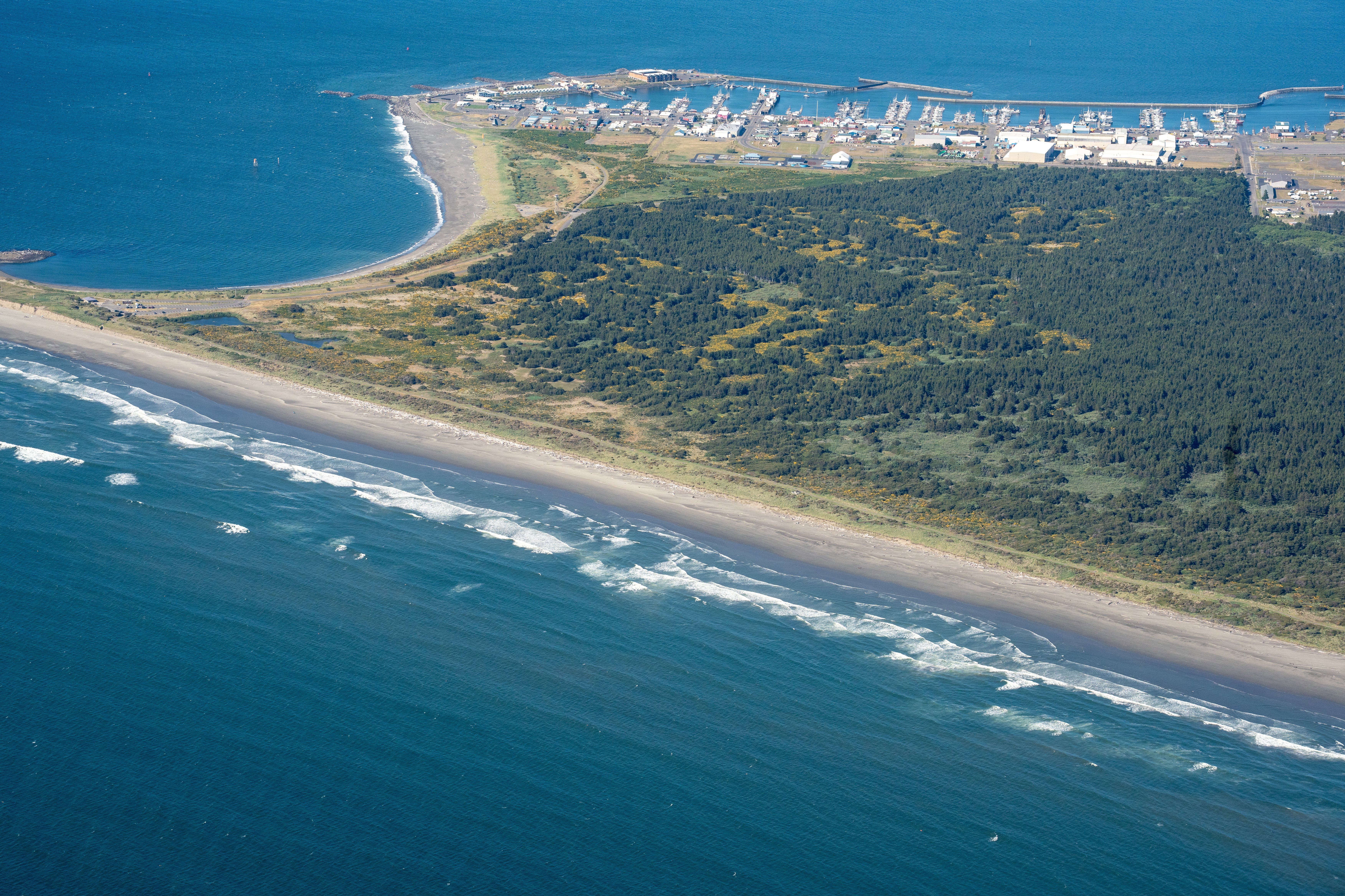
Case in point: the Westport Light State Park, an inviting swath of hemlock green amidst the more developed areas of coast. It could be replaced by a sprawling private golf course if the State Parks Commission approves the proposed Westport Golf Links project.
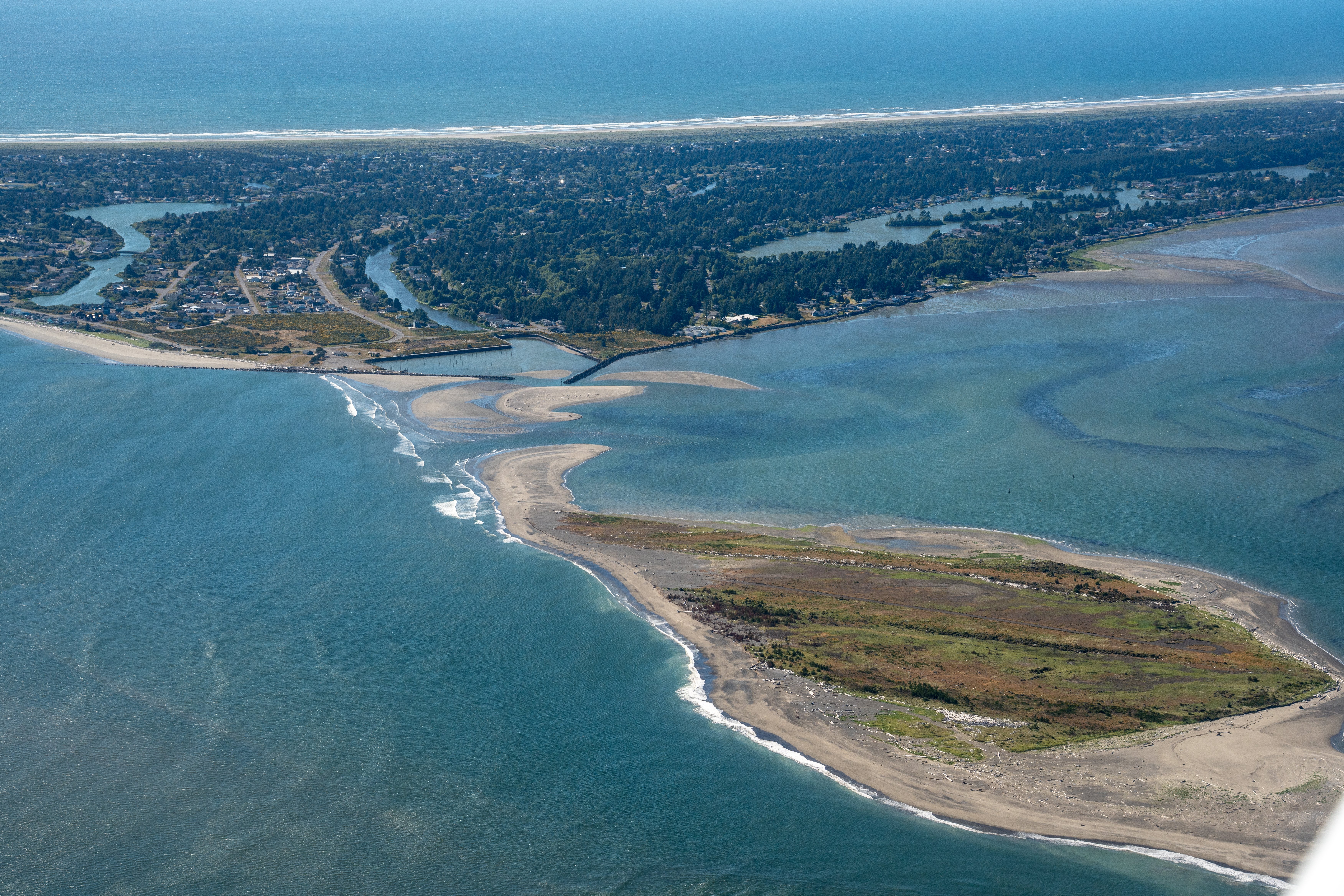
Another feature we were able to snag some photos of is the Damon Point area, which is undergoing some serious erosion that has already closed off public access to the beach in multiple places and is threatening infrastructure in Ocean Shores.
There’s something about the power of images to evoke feelings, and it’s our feelings that often drive us to take action. The images we collected during this flight will be used in our advocacy work to protect our coast - from supporting good policies to stopping bad projects. We’re so grateful for Lighthawk and their support of conservation efforts across the country. Special shout-out to our pilot Lane, who’s been flying since he was a wee lad (not his words), and our awesome volunteer and photographer Brendan for spending a long afternoon crammed in a tiny cockpit with a big camera.
 While completing her master's degree in Sustainable Development & Conservation Biology from the University of Maryland, Liz taught sustainability to undergraduate students while also volunteering as a docent at the Smithsonian Natural History Museum’s Ocean Hall. As Washington and Alaska Regional Manager, she supports the organization's six Washington chapters and the Kenai Peninsula Chapter in their amazing work.