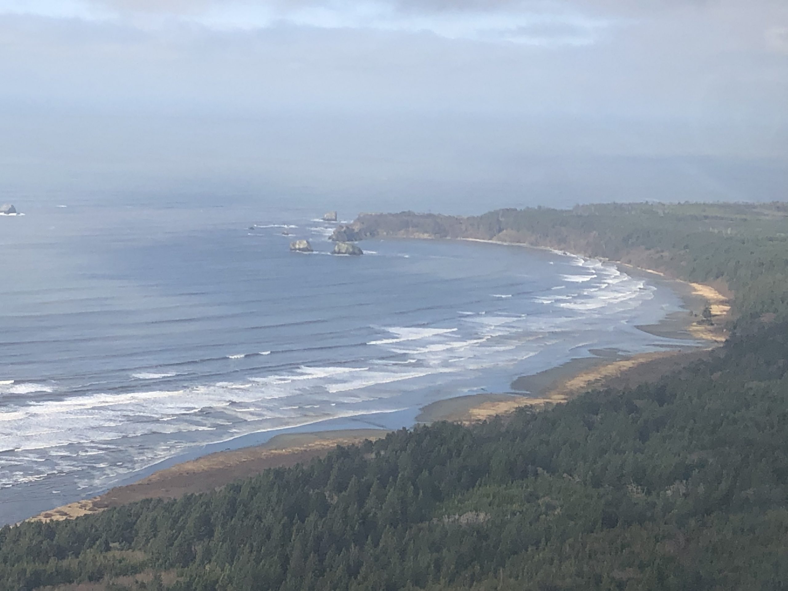
On Sunday, February 9th, I had the opportunity to participate in a flight along the Grays Harbor coastline thanks to the generous support of pilot Jane and LightHawk. Joining us was the Mayor of Ocean Shores and Surfrider Foundation Leadership Academy Alum, Crystal Dingler. Our mission for the day was to capture an aerial perspective of the King Tide event that was happening and see how it was interacting with the coastline and a few erosion hot spots.
In the simplest terms, king tide is colloquially used to describe an extremely high tide. Ordinary tides are caused by the gravitational pull between the Earth and the moon; king tides happen when astronomical events amplify that pull. Learn more via the Washington Sea Grant King Tides Program. Observing king tides today is valuable exercise as it gives us a window into what future challenges our coastal communities might face with expected sea level rise.

Photo by Gus Gates, Aerial support provided by LighHawk.
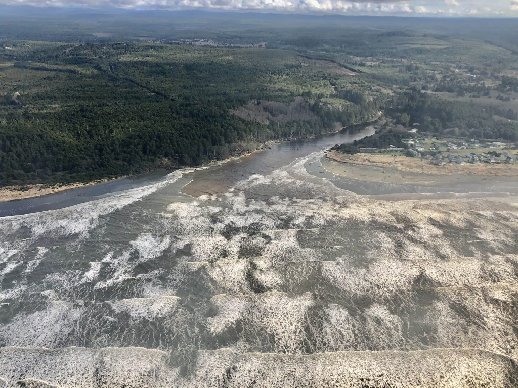
Given that it had rained 28 out of 31 days in January along with numerous atmospheric river events pointing the fire hose directly at Western Washington, the weather cooperated surprisingly well for our flight with partly cloudy skies and light winds. The surf was actually fairly mellow at 8 feet at 10 seconds, compared to 25 feet at 16 second swell that coincided with the January king tides. As a result, the water levels that we saw may not be as dramatic as they could've been with a large swell. All of the rivers that we saw were at bankfull width and running very turbid. We also saw several significant landslides and bluff erosion from recent rains.
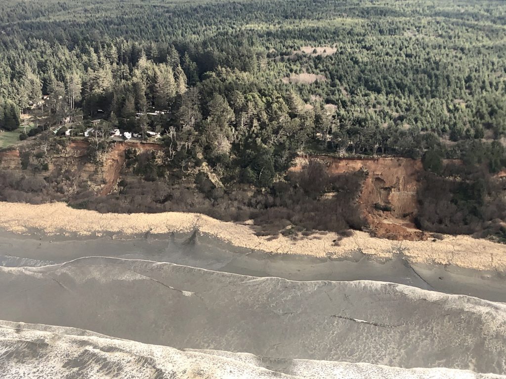
Coastal erosion is an integral part of natural beach processes. Beaches are not stagnant, but instead are dynamic systems that shift, migrate, fill and erode; sometimes taking and sometimes giving. While many coastal communities throughout the United States and around the world point to coastal erosion as the cause of their shrinking beaches, erosion really only becomes a problem when we build houses, roads and other structures too close to the water. Unfortunately that is how development has been occurring along our coasts, and we haven't given our beaches the room they need to naturally maintain themselves. Read more via the Surfrider Beachapedia page for Managed Retreat.
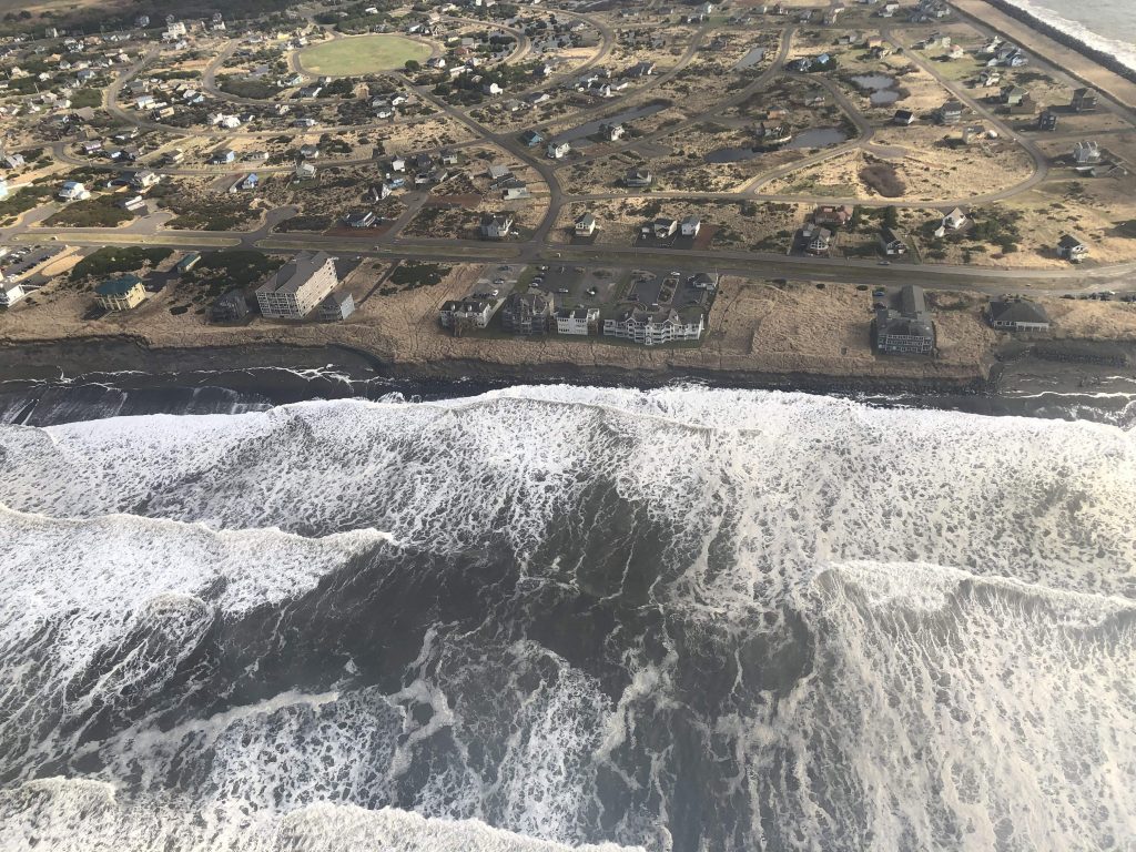
Photo Gus Gates, aerial support provided by LightHawk.
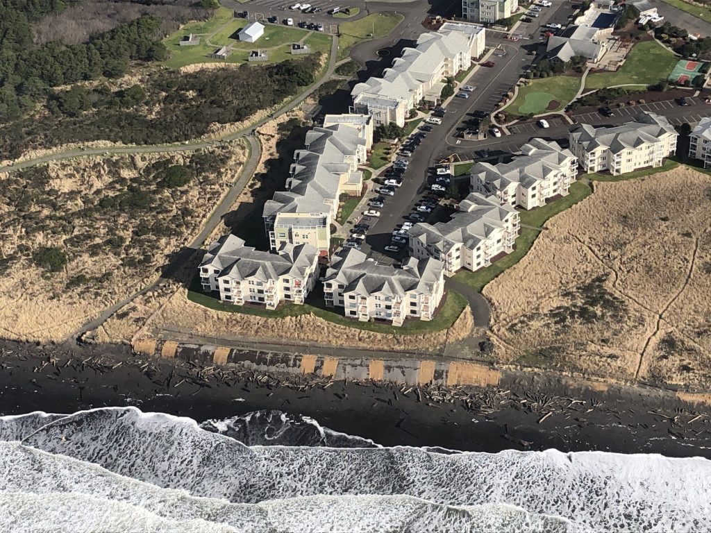
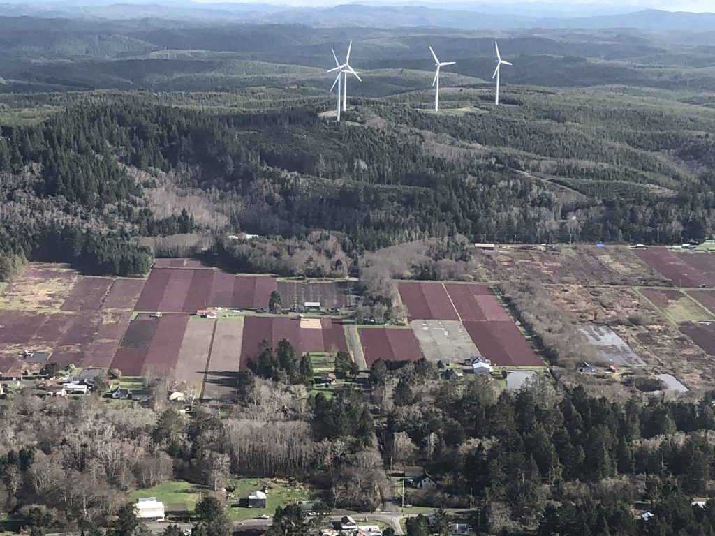
Photo by Gus Gates, aerial support provided by LightHawk.
The above pictures are case in point where development has occurred too close to the ocean. Sea level rise is a real and growing fear for Washington’s coastal homeowners, tribes and communities. In many places, today’s king tides will be “normal” high tides due to sea level rise. Thanks to constantly improving sea level rise projections, leaders, planners and decision-makers now have access to better information critical to plan for, and adapt to, Washington’s future. Rising seas are already damaging highways and sewers, intensifying erosion, shrinking beach access, causing rivers to flood and saltwater to seep into groundwater.
Read more about Surfrider's climate work at our website and on our activist toolkit.
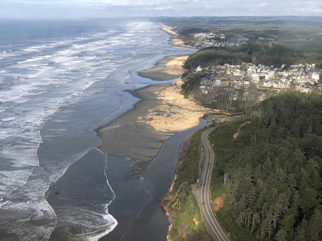
Photo by Gus Gates, aerial support provided by LightHawk.
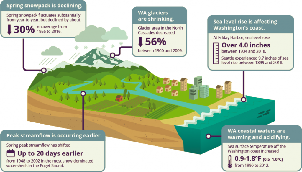
Washington state is particularly vulnerable to sea level rise. In the United States, 42% of the population lives along the coasts. Over 68% of Washingtonians (4.6 million people) live along or near the state’s 3,026 miles of coastline. Washington’s mountains and marine environment are vital economic and environmental resources, supporting some of the largest industries in the state, including forestry, agriculture, tourism and the maritime sector. Globally, annual coastal flood damages are projected to increase significantly, with floods becoming 100 to 1000 times more costly by 2100 compared to today. Excerpted from “Shifting Snowlines and Shorelines: The Intergovernmental Panel on Climate Change’s Special Report on the Ocean and Cryosphere and Implications for Washington State.” Briefing paper prepared by the Climate Impacts Group, University of Washington, Seattle.
The paper concludes with where we need to focus our action:
"Because these impacts are only projected to worsen, action is urgently needed to limit the rising financial, social and environmental risks
of continued warming. Avoiding ‘dangerous’ climate change requires significantly reducing global CO2 emissions well before 2030 to reach ‘net zero’ emissions around 2050. Action and investments are needed today to prepare and protect our communities, cultures, ecosystems and economies for the changes we can see coming. "
"With everyone on Earth connected to the ocean or cryosphere, we all stand to lose from continued warming. This means that we will all benefit from immediate action to prevent further warming and to prepare for the impacts of a climate-changed world. The choice is ours. The time is now. "
 As a co-founder of Oregon’s Siuslaw Chapter, to earning his policy chops as Oregon & Washington Policy Manager, to his current role as the West Coast Regional Director, Gus has been an active and inspiring member of the Surfrider network and staff for over 15 years. He attended Oregon State University to pursue a BS in Fisheries and Wildlife Science with a specialty in ecological restoration.