
Surfrider staff recently had the opportunity to participate in a flight provided by LightHawk to witness the December 4th King Tide along the Olympic Coast and Strait of Juan De Fuca in efforts to raise awareness about future sea level rise and promote coastal adaptation planning. Check out some of the cool pictures of some special places!
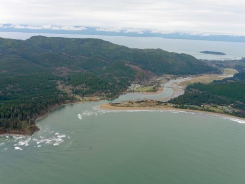
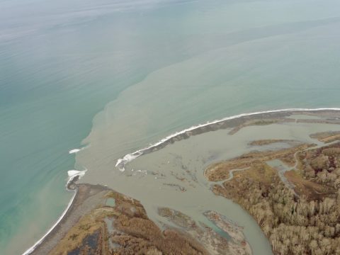 Elwha Rivermouth. Photo credit: Gus Gates, flight provided by LightHawk
What are "King Tides" anyways? While the term ‘king tide’ isn’t a scientific term, it is used to describe an especially high tide event occurring twice a year, when there is alignment of the gravitational pull between sun and moon. When king tides occur during cyclones, floods or storms, water levels can rise to higher levels and have the potential to cause great damage to property and the coastline. Learn more...
The king tides are no more than the very highest tides that occur at each place. They:
- occur naturally and regularly,
- are predictable and expected, and
- are not an every day occurrence
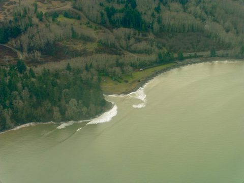 Twin Rivers. Photo credit: Gus Gates, flight provided by LightHawk.
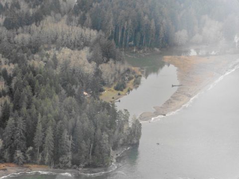 Strait of Juan De Fuca. Photo credit: Gus Gates, flight provided by LightHawk.
Recently, Surfrider partnered with LightHawk to organize flights along both coasts to capture the November and December king tides. As Surfrider flew along our coasts, we witnessed firsthand how higher tides pose significant problems for coastal infrastructure. From Washington to Mexico and from Maine to Florida, we saw thousands of structures that will eventually be exposed to rising seas; prompting the question of how will local communities respond to (or, hopefully, proactively prepare for) sea level rise...? Check out some of the photos from around the country in Surfrider Coastal Preservation Manager Stefanie Sekich-Quinn's Coastal Blog Post.
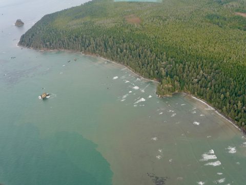 Small swell and no beach, Olympic Coast National Park & Olympic Coast National Marine Sanctuary. Photo credit: Gus Gates, flight provided by LightHawk.
 Hobuc beach and Makah Reservation. Photo credit: Gus Gates, flight provided by LightHawk.
"We took the opportunity to view King Tides from the air in order to better understand future impacts of sea level rise and to motivate local municipalities to proactively protect our shorelines and coastal communities. It is imperative that local communities work together to preemptively turn the tide now to avoid the loss of beaches, homes, communities, public access, recreation and ecosystems. Once these unique and special areas are gone, they’re gone for good." Stefanie Sekich-Quinn, Surfrider Foundation Coastal Preservation Manager.
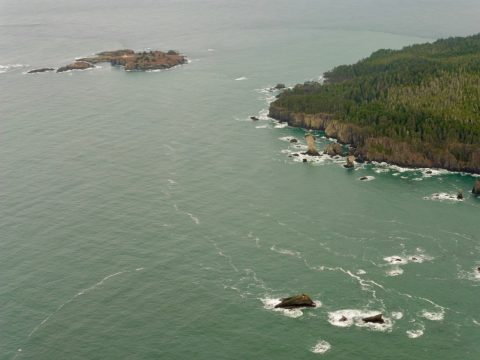 Tatoosh Island & Cape Flattery. Photo credit: Gus Gates, flight provided by LightHawk.
The challenge of how we go about planning for Sea Level Rise connects directly to our work in Washington to update the Shoreline Master Plans in Pacific and Grays Harbor Counties. Casey Dennehy, Surfrider Washington Coastal Program Manager, has been our lead in this collaborative planning effort for many years and also represents recreational ocean users on the Washington Coastal Marine Advisory Council (WCMAC). WCMAC is currently wrapping up their work on Washington's Marine Spatial Plan, and will be shifting their focus towards Coastal Resiliency in 2018, if you're interested in this topic, now is a great time to get involved!
Speaking of getting involved: There will be another round of king tides coming up in early January, between the 1st thru 5th, depending on your location. Washington Sea Grant is coordinating efforts to raise awareness about king tides in Washington and you can help in the effort by capturing photos of the event and uploading them to their site.