What is a king tide?
Every now and then, forces align just right. Next week (and again in mid-December), the gravitational forces of the sun, earth, and moon, are lining up to create a king tide. King tides, also known as perigean spring tides, happen a few times a year when the sun, moon, and earth line up (during full and new moons) and the moon's orbit brings it a little closer to the Earth than usual (here's a short cartoon to help visualize it).
Why are king tides important?
Here in Washington, we see a few king tides each year, typically in the winter, and they provide a valuable glimpse into our future.
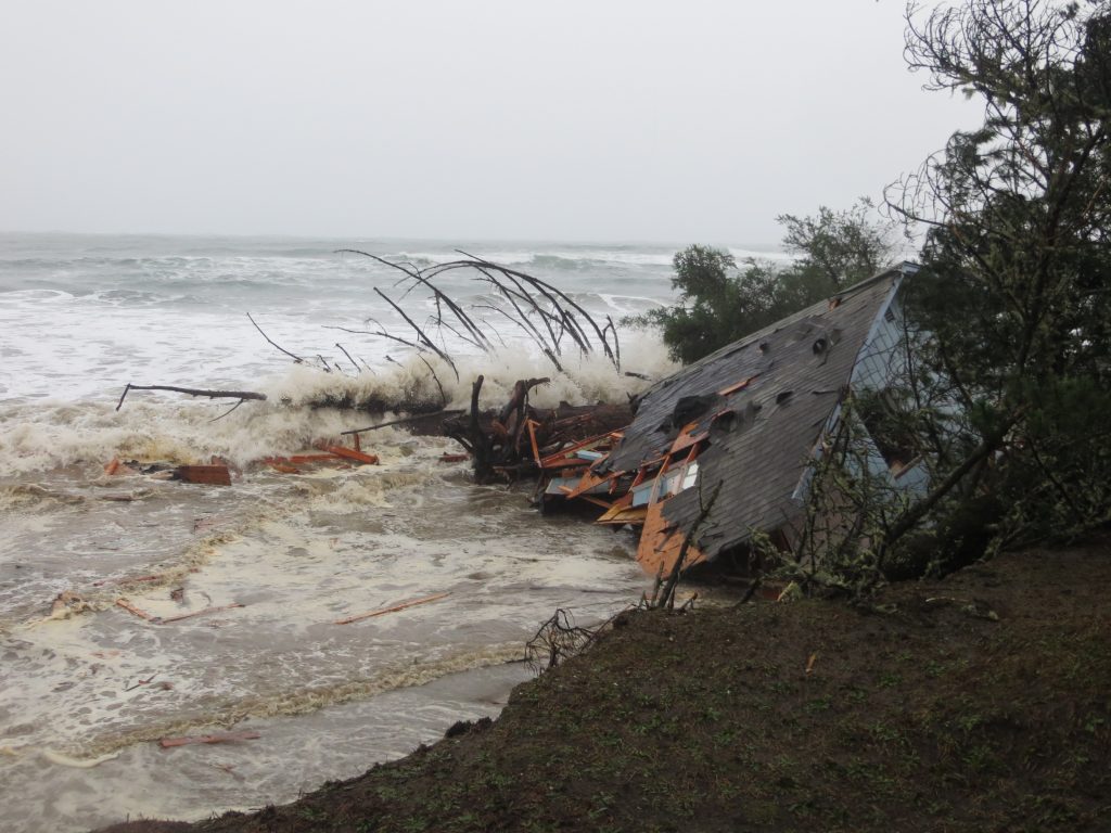
By now we're all familiar with the threats that sea level rise presents - coastal and inland flooding, erosion, damage to infrastructure, and groundwater contamination, to name a few. Additional impacts include rising insurance premiums that decrease coastal communities' economic resilience to natural disasters. Even the internet isn't safe -- over 4000 miles of internet cable are at risk to flooding and inundation in the next 12 years, with Seattle listed as one of the top three at-risk cities.
Close to half of the US lives on or near the coast, and here in Washington, 68% of our residents reside within the coastal zone. The effects of climate change and sea level rise are and will continue to be felt far and wide.
What can we do?
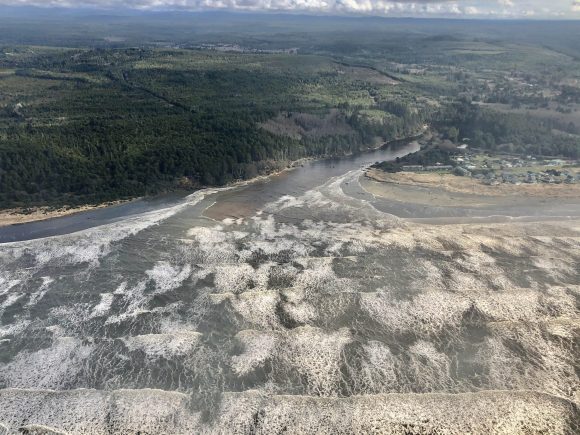
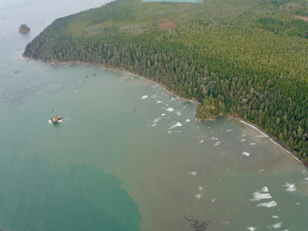
A picture's worth a thousand words. Images of our king tides tell a story, one of urgency and a need for action. We need your help collecting images of king tides so that we can communicate the urgency of this threat to our leaders.
If you happen to be out and about in your community during an upcoming king tide, please snap a few photos and/or videos (especially if you have a drone!), and send them (along with the location) to Stefanie Sekich Quinn, Surfrider Foundation's Coastal Preservation Manager, at Ssekich@surfrider.org with the subject “King Tides.”
Another great way to be a part of the community science happening around this is to share your king tide photos by downloading the iPhone/Android MyCoast app. This app stamps photos with local atmospheric and tidal information, so it helps people communicate local flooding issues to agencies, planners, and more. You can visit the MyCoast.org website to see some WA king tide photos.
Find out when to expect king tides in your area on Washington Sea Grant's King Tide Calendar (Updated for 2022-2023 season).
Every action we take both individually and collectively to fight climate change, reduce our carbon footprint, and replace fossil fuels with renewable energy is a step towards a sustainable future. Drive less, eat more plants, conserve water and electricity, and most importantly, demand systemic change by holding your elected officials accountable and pressuring them to take immediate and decisive action on climate change.
For more information on sea level rise, king tides, and impacts to Washington:
- February's blog post, King Tides and the Need for Coastal Resilience
- Our one-page WA Coast Sea Level Rise Handout
- Surfrider's Beachapedia page on Sea Level Rise
- NOAA's interactive Sea Level Rise Viewer
- Climate Central's Surging Seas Risk Zone Map has a slide bar allowing you to see what areas are likely to be inundated with rising seas
- SeaLevelRise.org provides an overview of options and solutions for coastal communities managing sea level rise
- Check out Surfrider’s climate change activist toolkit
A member of our community just shared this drone footage of the most recent king tide in Westport, WA: